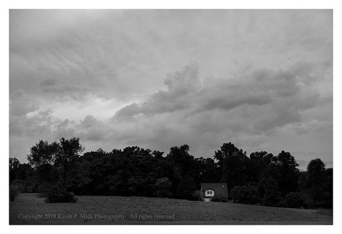
Building
September 4, 2018

Copyright 2018 Kevin P. Mick Photography. All rights reserved.
It is interesting to watch the changes in clouds as a storm builds…

Copyright 2018 Kevin P. Mick Photography. All rights reserved.
delivers…
Copyright 2018 Kevin P. Mick Photography. All rights reserved.
and dissipates.
This was a very minor storm without much rumbling or rain. In fact, it felt quite nice to stand outside and feel the precipitation. Such is not the case with Typhoon Jebi, which hit Japan today. Tropical Storm Gordon smacked parts of Florida and is now forecast to morph into a hurricane before hitting the U.S. Gulf Coast later today. Meanwhile, Hurricane Florence is spinning out in the Atlantic-time will tell if that storm becomes a threat.
This article from earlier in the summer provides a useful explanation about the factors used to forecast the number of storms in a given hurricane season-please note that this is for the Atlantic basin, so storms like Typhoon Jebi would not be included. This is a complex discipline that requires the analysis of multiple data points. Having presented that information, the author, Dr. Marshall Shepherd, concludes with perhaps the most important point.
Take care.
9/6/18 UPDATE: This is the latest regarding Hurricane Florence.
