A Walk
July 25, 2019
Copyright 2019 Kevin P. Mick Photography. All rights reserved.
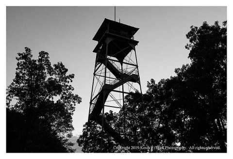
I have been visiting the Gettysburg battlefield for decades-it has served as the subject of many posts within this blog over the years. There is an observation tower just off Confederate Avenue and, once at the top…
Copyright 2019 Kevin P. Mick Photography. All rights reserved.
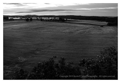
when looking east, it is possible to engage a view of the distance between the area where Confederate soldiers hunkered down (now named Confederate Avenue) in preparation for the battle, and the High Water Mark (the point of their furthest progress during the battle-that is across the Emmitsburg Road, which runs along the top of the above photograph)…

Copyright 2019 Kevin P. Mick Photography. All rights reserved.
and the two Round Tops, which were prized during the three-day battle; the Union soldiers occupied that ground. It was across the open field depicted in both photographs that the Confederate soldiers advanced.

Copyright 2019 Kevin P. Mick Photography. All rights reserved.
Despite the numerous visits and the research I have done about the battles there, I recently realized that I have never walked that route-I have driven it thousands of times, but that is not the same-the distance is covered much too quickly under motorized transport. A paved road now connects Confederate Avenue and the Emmitsburg Road so there is no need to actually cross the field. Yesterday offered a brilliantly cool morning to make that walk.

Copyright 2019 Kevin P. Mick Photography. All rights reserved.
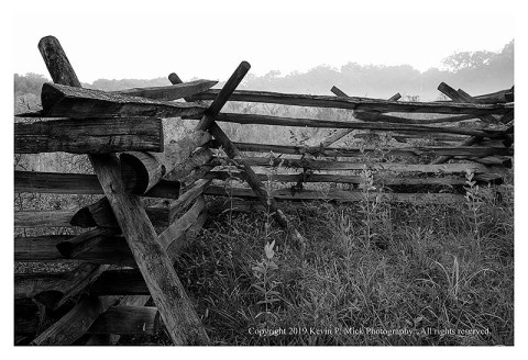
Along the way, is the Peach Orchard…
Copyright 2019 Kevin P. Mick Photography. All rights reserved.
and the Wheat Field-both were sites of fierce fighting.
It was bit over 3 miles to walk from Confederate Avenue, cross the Emmitsburg Road, make the loop around the Wheat Field, and return. It took about 15-20 minutes to cover the area represented by that open field. One can research the accounts left by soldiers who participated in the fighting-Ken Burn’s The Civil War is useful for that purpose. Making that walk reinforces just how relatively small and tremendously exposed the individual Confederate soldiers were-they were visible to the Union soldiers arrayed across the higher ground from the moment they mustered onto the field and began the march. Both armies would have been quite aware of what carnage was about to be unleashed-and there was (is) no place to hide, even if one wanted to do so.
Copyright 2019 Kevin P. Mick Photography. All rights reserved.
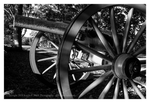
It goes without saying that no one was shooting at me as I walked and made photographs-the cannon along the way are silent-the air was clear. I could take my time. I could stop when I wanted. I could take a drink of water as needed.
I could also drive away when finished.
Take care.
